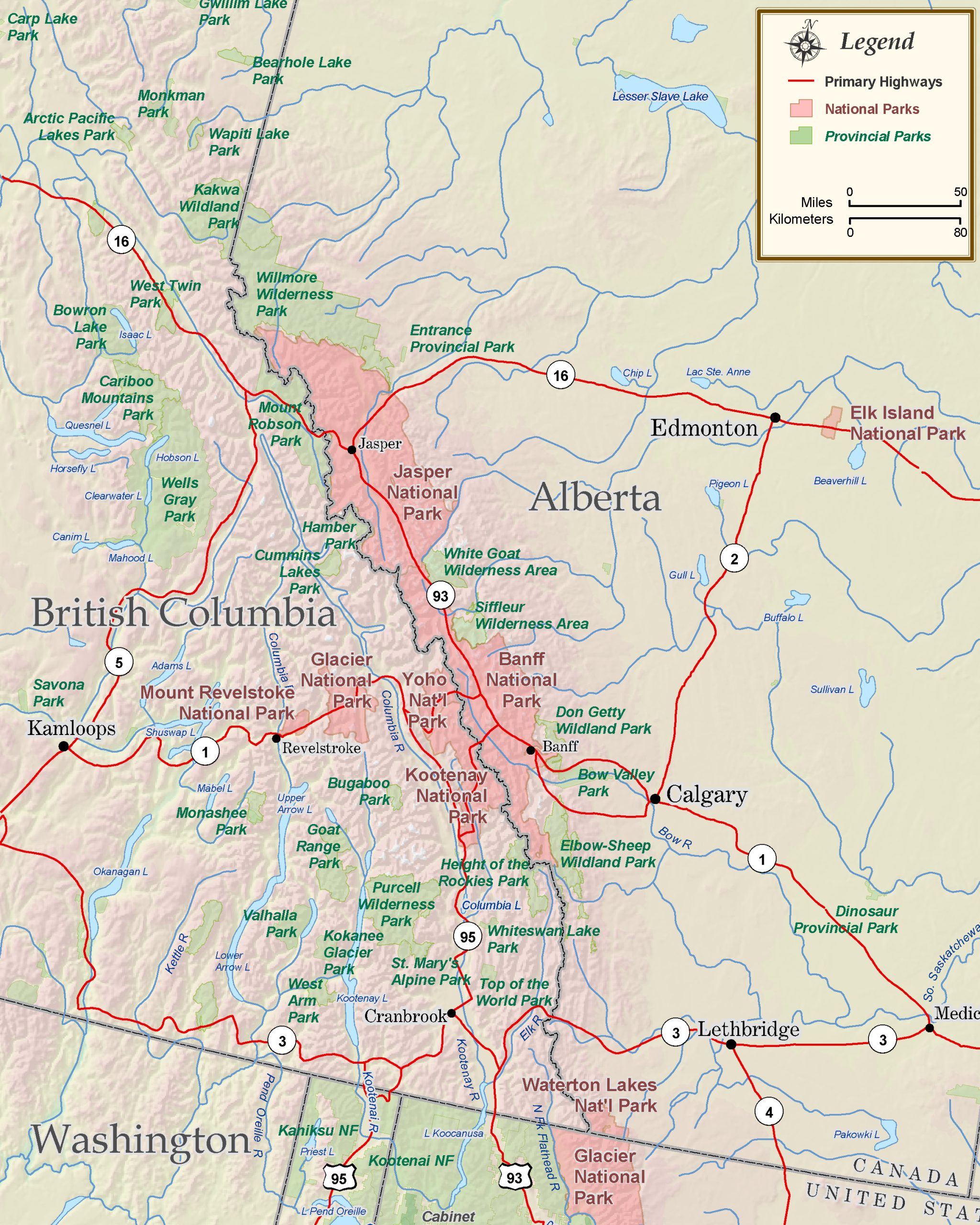
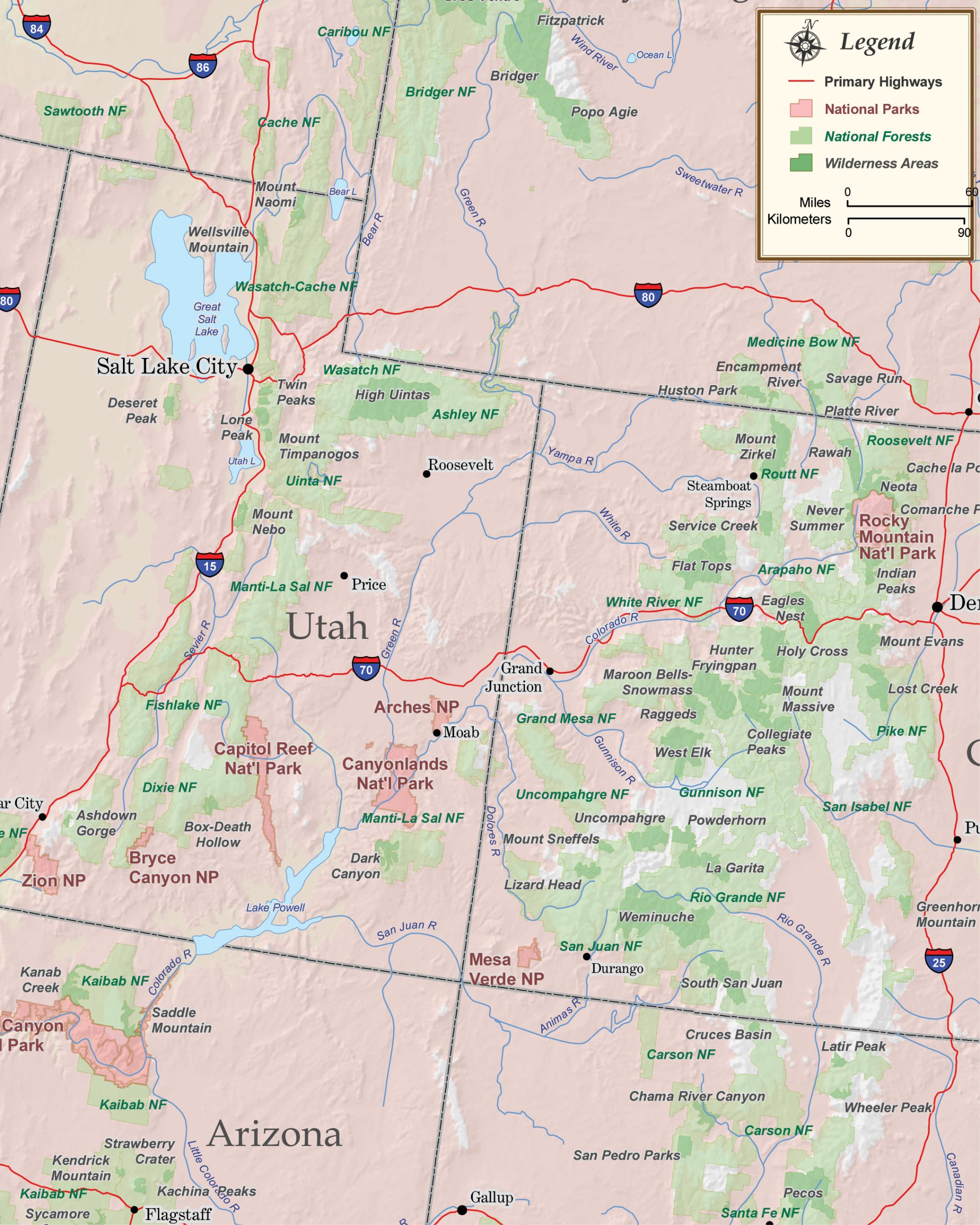
AfrikaansAlbanianArabicBelarusianBulgarianCatalanChineseCroatianCzechDanish
DutchEnglishEstonianFilipinoFinnishFrenchGalicianGermanGreekHebrew
HindiHungarianIcelandicIndonesianIrishItalianJapaneseKoreanLatvianLithuanian
MacedonianMalayNorwegianPersianPolishPortugueseRomanianRussianSerbianSlovak
SlovenianSpanishSwahiliSwedishThaiTurkishUkrainianVietnameseWelshYiddish

Welcome To Our New Map Gallery!

The map gallery is now open!

Although we have been selling maps and guidebooks online since 1999, our newly established map gallery in our home town of Missoula, Montana, provides us with a unique space in which to display all of our current products as well as our large and growing selection of beautifully framed and unframed wall maps.

The gallery features art maps, antique maps, reproductions, satellite image posters and raised relief maps focusing on Montana and the Rocky Mountain region. We also carry an excellent selection of US and world wall maps, folded travel maps, road atlases, videos, and guidebooks for the national parks, forests and wilderness areas within the Rocky Mountain west.

We are located at 3213 Brooks Street, Missoula, Montana in the yellow building just south of the light at Brooks and Paxson. Gallery hours are 10am to 5pm Tuesday through Saturday. Feel free to give us a call at (406) 542-1541 or (866) 695-0931.


Bundle image

Save 10% with bundle discounts!

We've hand selected and bundled many of our guidebooks and maps together for a richer traveling experience. As you use your map to plan or guide your travels, read all about the area with the accompanying guidebook. It's a natural! And they're all 10% off!


Featured Destination Link:

Canoeing Montana's Wild & Scenic Upper Missouri River

After almost a full year of planning, our small group of friends was finally hitting the road to begin a five-day float of the White Cliffs section on Montana's Wild and Scenic Upper Missouri River. We left Missoula and Seeley Lake with three canoes, three vehicles and a week's worth of food, drink and gear. After a brief stop in Fort Benton (a very cool little town loaded with river history) to discuss our final itinerary with Glen and Nancy Monihan of Upper Missouri River Outfitters, we were off for the launch site at Coal Banks Landing, approximately thirty miles to the northeast. We arrived at Coal Banks Landing late in the afternoon to find the campground empty except for a couple of parked vehicles. Read more.